Nassau County, NY Map - with Local Streets
About This Map
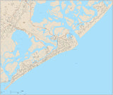
Nassau County, NY (Long Island) with highways, major roads, and local streets. One preview image shows the entire area included on the map, and the other shows a small area at 100 percent and the Layers Palette.
All areas and streets are fully editable Adobe Illustrator objects, and all text is font text (not outlines). Layers make it easy to customize the appearance of the map using the tools in Adobe Illustrator.
Perfect for large color illustrations in print or web design.
This map shows all of Nassau County, NY, including the towns of: Atlantic Beach, Baxter Estates, Bayville, Bellerose, Brookville, Cedarhurst, Centre Island, Cove Neck, East Hills, East Rockaway, East Williston, Farmingdale, Floral Park, Flower Hill, Freeport, Garden, Glen Cove, Great Neck, Great Neck Estates, Great Neck Plaza, Hempstead, Hewlett Bay Park, Hewlett Harbor, Hewlett Neck, Island Park, Kensington, Kings Point, Lake Success, Lattingtown, Laurel Hollow, Lawrence, Long Beach, Lynbrook, Malverne, Manorhaven, Massapequa Park, Matinecock, Mill Neck, Mineola, Munsey Park, Muttontown, New Hyde Park, North Hempstead, North Hills, Old Brookville, Old Westbury, Oyster Bay, Oyster Bay Cove, Plandome, Plandome Heights, Plandome Manor, Port Washington North, Rockville Centre, Roslyn, Roslyn Estates, Roslyn Harbor, Russell Gardens, Saddle Rock, Sands Point, Sea Cliff, South Floral Park, Stamford, Stewart Manor, Thomaston, Upper Brookville, Valley Stream, Westbury, Williston Park, Woodsburgh.
If you need a map like this one showing a different area, please contact our Custom Mapping Services.
How Will I Download My Digital Map File?
Your receipt page will have a link to download your file, and you will receive an email with the same link. The link will be active for 30 days.
30 Day Money-Back Guarantee!
Download a Sample Map
See for yourself why our maps are the best! Download a fully editable sample map in Adobe Illustrator or PowerPoint Format.
Can't Find the Map You Need?
We can make one for you. Here's how to get a custom map...
Similar Maps