Fit Together 48 US States: with Counties and Terrain
About This Map Collection
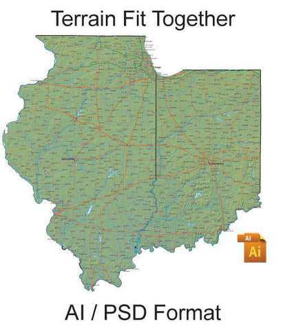
A collection of the 48 contiguous US state maps with counties plus terrain background designed specifically so they will fit together like puzzle pieces. Using Adobe Illustrator's Paste in Front function makes it easy to combine maps into custom regions. All for for only $299!
Maps show every county county names plus highways cities lakes rivers etc.? All features are fully editable.? See Layes/Features for complete list of the features on these maps each on a different Adobe Illustrator layer.? The terrain background map image is a linked Photoshop (PSD) file.
Maps of the 48 contiguous states
- set of all 48 contiguous states to make custom regions
- terrain background in high res 300 dpi CMYK Photoshop
View all the maps in this product.
Layered vector maps are easy to use
- Edit place names colors lines with Adobe Illustrator
- Features saved in separate layers - easy to turn on or off
- All text is font-based not outlines
- Areas (such as counties) drawn as objects you can select
- Terrain background in high res 300 dpi CMYK Photoshop
Royalty Free for print and web use.
Adobe Illustrator (AI) format. The terrain is a linked Photoshop (PSD) file.
How Will I Download My Digital Map File?
Your receipt page will have a link to download your file, and you will receive an email with the same link. The link will be active for 30 days.
30 Day Money-Back Guarantee!
Download a Sample Map
See for yourself why our maps are the best! Download a fully editable sample map in Adobe Illustrator or PowerPoint Format.
Can't Find the Map You Need?
We can make one for you. Here's how to get a custom map...
Similar Maps

