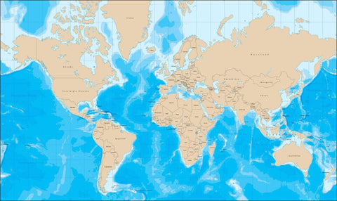
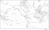
World Map with Political Boundaries and Contours in the Water with Country Names in German
About This World Map with Contours and Countries in German
Includes contours in the water, with country borders and namesåÊin German.
In Illustrator format, all contour lines and areas are fully editable vector objects, in separate layers, so you can easily change the colors as needed.
Perfect for color illustrations in print or web design.
Weltkarte mit Kontur im Wasser und jedes Land Grenze mit deutschen LÌÎ_ndernamen
MC-EUR-DE5260
EnthÌ_lt Konturen im Wasser, mit Landesgrenzen.
Im Illustrator-Format sind alle Konturlinien und FlÌ_chen voll editierbare Vektorobjekte, in separaten Ebenen, so dass man die Farben nach Bedarf leicht Ì_ndern kann.
Perfekt fÌ_r Farbabbildungen im Print- oder Webdesign.
WÌ_hlen Sie ein Dateiformat aus und klicken Sie auf "In den Warenkorb". Nach dem Kauf ist Ihre Quittungsseite ein Link zum Herunterladen der Datei.
How Will I Download My Digital Map File?
Your receipt page will have a link to download your file, and you will receive an email with the same link. The link will be active for 30 days.
30 Day Money-Back Guarantee!
Download a Sample Map
See for yourself why our maps are the best! Download a fully editable sample map in Adobe Illustrator or PowerPoint Format.
Can't Find the Map You Need?
We can make one for you. Here's how to get a custom map...
Similar Maps

