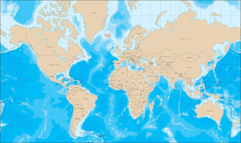
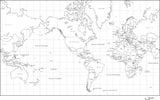
World Map with Political Boundaries and Contours in the Water with Country Names in French
About This World Map with ContoursåÊwith Country Names in French
Includes Political Boundaries and Contours in the Water with Country Names in French.
In Illustrator format, all contour lines and areas are fully editable vector objects, in separate layers, so you can easily change the colors as needed.
Perfect for color illustrations in print or web design.
À propos de cette carte du monde avec contours
Comprend les fronti̬res politiques et les contours dans l'eau avec les noms de pays en fran̤ais.
En format Illustrator, toutes les lignes et zones de contour sont des objets vectoriels enti̬rement modifiables, dans des calques distincts, vous pouvez donc facilement changer les couleurs au besoin.
Perfectionnez pour des illustrations en couleur dans la conception d'impression ou de Web.
Cette carte du monde est dans la Projection Mercator.
Apr̬s l'achat, votre page de r̩ception est un lien pour t̩l̩charger le fichier.
How Will I Download My Digital Map File?
Your receipt page will have a link to download your file, and you will receive an email with the same link. The link will be active for 30 days.
30 Day Money-Back Guarantee!
Download a Sample Map
See for yourself why our maps are the best! Download a fully editable sample map in Adobe Illustrator or PowerPoint Format.
Can't Find the Map You Need?
We can make one for you. Here's how to get a custom map...
Similar Maps

