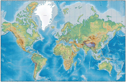
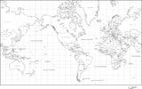
World Map with Land and Ocean Floor Terrain with Country Names in French
About This World Map with Land & Ocean Floor Terrain and Country Names in French
Includes terrain relief image in the land with country borders, and country names in French.
In Illustrator format the background terrain is a 300 dpi CMYK Photoshop file so you can alter the background colors easily to your design specifications.
Dimensions about 17 x 11 in (43.18 x 27.94 cm). Perfect for color illustrations in print or web design.
This world map is in the Mercator Projection.
Au sujet de cette carte du monde avec le terrain de terre et d'océan avec des noms de pays en français
Inclut l'image de relief de terrain dans le pays avec les frontières de pays, et noms de pays en français.
En format Illustrator, le fond de fond est un fichier CMJN Photoshop de 300 dpi, vous permettant ainsi de modifier facilement les couleurs de fond selon vos spécifications de conception.
Dimensions 17 x 11 in (43.18 x 27.94 cm). Perfectionnez pour des illustrations en couleur dans la conception d'impression ou de Web. Cette carte du monde est dans la Projection Mercator.
Après l'achat, votre page de réception est un lien pour télécharger le fichier.
How Will I Download My Digital Map File?
Your receipt page will have a link to download your file, and you will receive an email with the same link. The link will be active for 30 days.
30 Day Money-Back Guarantee!
Download a Sample Map
See for yourself why our maps are the best! Download a fully editable sample map in Adobe Illustrator or PowerPoint Format.
Can't Find the Map You Need?
We can make one for you. Here's how to get a custom map...
Similar Maps

