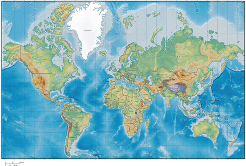
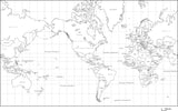
World Map with Land and Ocean Floor Terrain with Country Names in Italian
About This World Map with Land and Ocean Floor Terrain with Country Names in Italian
Includes terrain relief image in the land with country borders and country names in Italian.
In Illustrator format the background terrain is a 300 dpi CMYK Photoshop file so you can alter the background colors easily to your design specifications.
Perfect for color illustrations in print or web design.
This world map is in the Mercator Projection.
A proposito di questa mappa del mondo con Terra e Fondale marino terreno con il paese i nomi in italiano
Un'immagine in rilievo del terreno nel paese con i confini e nomi di nazioni in italiano include.
Nel formato Illustrator il terreno di fondo è un 300 dpi file CMYK Photoshop in modo da poter modificare i colori di sfondo facilmente alle vostre specifiche di progetto.
Perfetto per le illustrazioni a colori in stampa o di web design. Questa mappa del mondo è nella proiezione di Mercatore.
Dopo l'acquisto la pagina di ricevuta è un link per scaricare il file.
How Will I Download My Digital Map File?
Your receipt page will have a link to download your file, and you will receive an email with the same link. The link will be active for 30 days.
30 Day Money-Back Guarantee!
Download a Sample Map
See for yourself why our maps are the best! Download a fully editable sample map in Adobe Illustrator or PowerPoint Format.
Can't Find the Map You Need?
We can make one for you. Here's how to get a custom map...
Similar Maps

