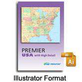
Premier USA with High Detail
About This USA with High Detail Map Collection
Poster size maps of the USA and all 50 states, perfect for producing large format trade show displays or wall maps. A great value because with the collection you get over 200 of our best US maps for one price.
211 maps of the USA & all 50 states
- 11 USA country maps with all 3000+ counties as separate objects
- All 50 states; 4 versions of each state
- Over 40 feature layers including counties roads cities
- Large format maps with lots of detail
Layered vector maps are easy to use
- Edit all colors fills, line specs, and text with Adobe Illustrator
- Features saved in separate layers - easy to turn on or off
- All text is font-based not outlines
- Areas (such as countries) drawn as objects you can select individually
Delivered as a single ZIP download, about 425MB.
How Will I Download My Digital Map File?
Your receipt page will have a link to download your file, and you will receive an email with the same link. The link will be active for 30 days.
30 Day Money-Back Guarantee!
Download a Sample Map
See for yourself why our maps are the best! Download a fully editable sample map in Adobe Illustrator or PowerPoint Format.
Can't Find the Map You Need?
We can make one for you. Here's how to get a custom map...
Similar Maps

