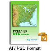
Premier USA plus Terrain
About This Map Collection
A comprehensive collection of USA and state maps with gorgeous terrain relief, political boundaries, and many other features. You get maps of the USA, plus all 50 states, for one low price.
Each map is actually two files that work together.
A layered and editable Adobe Illustrator file contains all the map line features (rivers highways coastlines etc) as vector objects and text as fully editable font text.
At the "bottom" of this file is a layer linked to the Adobe Photoshop file containing the terrain image. (300 dpi CMYK format). The relief file can be opened in any version of Photoshop if you would like to change the terrain colors.
152 Terrain Maps of the USA and Every State!
- 4 USA maps with states
- 50 State maps in three styles
- All maps include cities roads etc
- See complete list of Layers/Features below
- All features are fully editable
- Includes Fit-together state terrain maps
Layered vector maps are easy to use
- Edit colors lines & text with Adobe Illustrator
- Features saved in separate layers - easy to turn on or off
- All text is font-based not outlines
- Areas (such as countries) drawn as objects you can select
- Terrain background in high res 300 dpi CMYK Photoshop
Royalty free for print web and broadcast.
How Will I Download My Digital Map File?
Your receipt page will have a link to download your file, and you will receive an email with the same link. The link will be active for 30 days.
30 Day Money-Back Guarantee!
Download a Sample Map
See for yourself why our maps are the best! Download a fully editable sample map in Adobe Illustrator or PowerPoint Format.
Can't Find the Map You Need?
We can make one for you. Here's how to get a custom map...
Similar Maps

